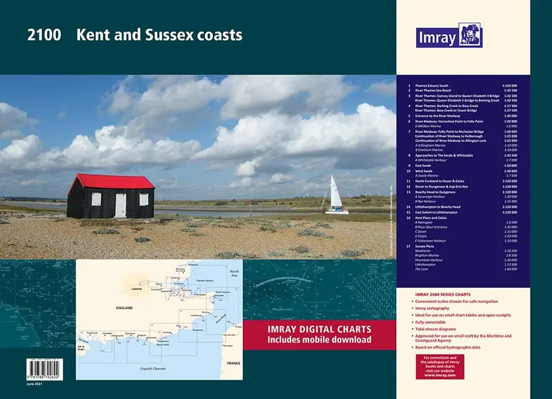
Description
A handy-sized A2 pack of charts covering the Kent and Sussex coasts.
This fully revised and extended edition includes the latest official UKHO data combined with additional information sourced from Imray”s network to make it ideal for small craft.
It includes 5 extra chart sheets and incorporates all the latest official bathymetric surveys. The latest harbour developments at Dover and Calais are also included. The plan of The Looe has had a scale increase to provide larger scale coverage. Passage planning sheets are now at a uniform scale of 1:120 000 and coverage extends as far West as the Isle of Wight. Coverage of The Swale has increased to 1:20 000 and split over two sheets.
An additional chart has been added showing large scale coverage of the River Swale approaches from the East and a new harbour plan of Swale Marina has been added. Coverage of the River Medway is now at a scale of 1:20 000 giving twice as much chart detail than previously shown, this increased scale continues all the way to Allington Lock.
Larger scale coverage of the River Thames from Barking Creek to Tower Bridge is also included. There has been general updating throughout.
Explore more from our collection.
Reviews
There are no reviews yet.